
Research Tools
We develop and operate digital tools and services that support researchers, teachers and students in discovering, analyzing, annotating and publishing digital resources.
Our Tools and Services
Our applications combine proven library services with innovative technologies from the fields of digital humanities, research data management and artificial intelligence. The aim is to make research more sustainable, more comprehensible and better networked.
The SUB Göttingen's digital tools are modular and openly available. Many of our developments are created in cooperation with partner institutions of the Göttingen Campus, DARIAH-DE and the NFDI initiatives - for a networked, open and future-proof research landscape.
Document Viewer TIFY (IIIF)
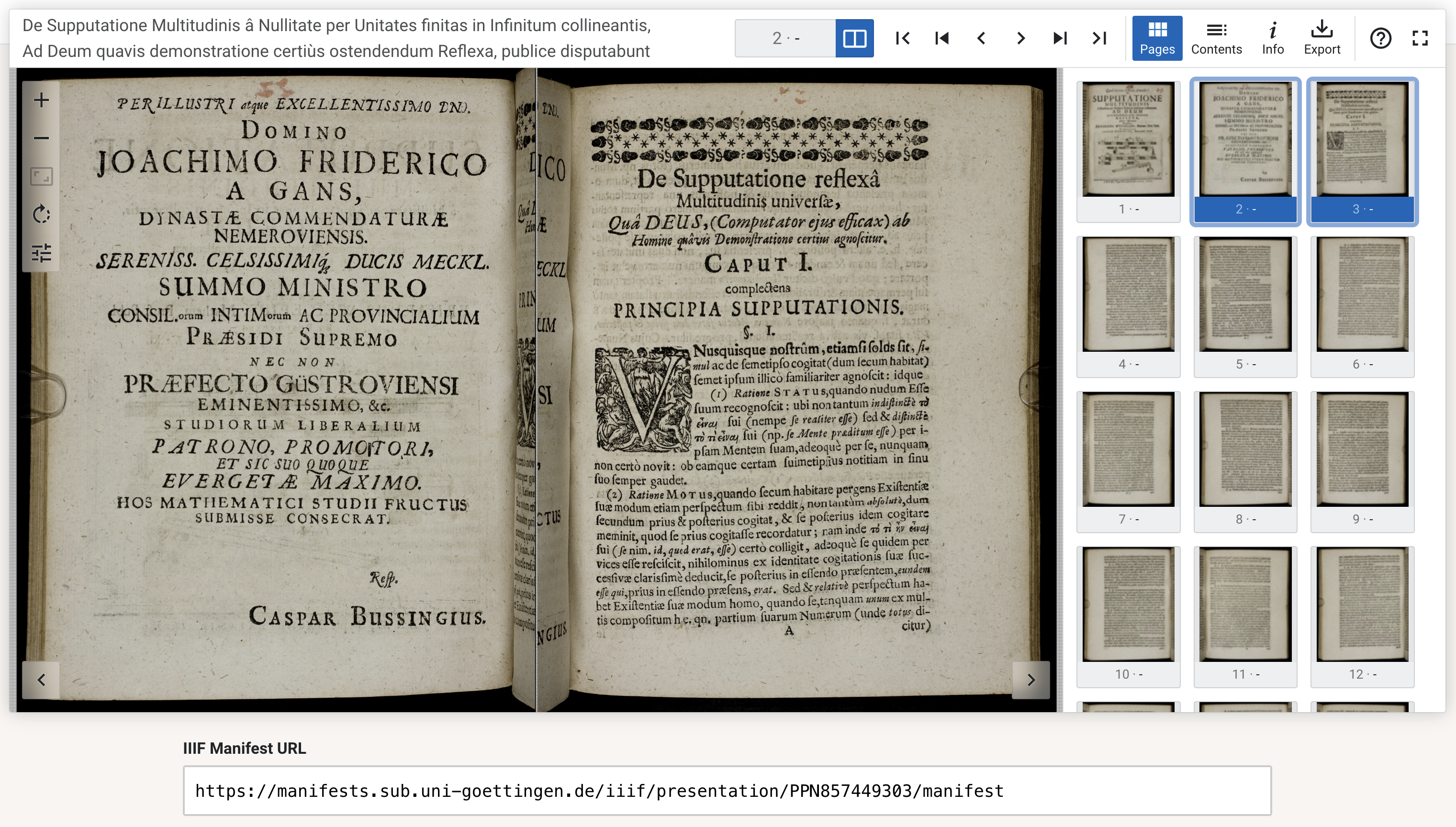
TIFY is a lean, JavaScript-based IIIF document viewer developed by the SUB Göttingen and optimized for mobile devices. It offers a fast and easy-to-use interface. TIFY can also display full texts.
IIIF stands for International Image Interoperability Framework and defines various APIs (application programming interfaces) that provide a standardized method for describing and displaying images for the web as well as structural metadata for presentation. IIIF consists of four APIs: Two core APIs (Image and Presentation) and two add-on APIs (Authentication and Content Search). This allows books, newspapers, manuscripts, maps, scrolls, collection and archive material to be shared between institutions and repositories worldwide with minimal effort.
These images and metadata can be processed and displayed with any IIIF-compatible application. The SUB Göttingen is a member of the IIIF consortium.
IIIF-compliant repositories offered by the SUB Göttingen:
- Göttingen Digitisation Centre (GDZ) - Digital Library for Historical Sources
- Alliance and national licenses repository
- Scientific Collections of the Georg-August-University Göttingen
- TextGrid - Digital library for scholarly editions
TIFY is available under the GNU Affero General Public License (AGPL). A demo installation and the source code are available on GitHub.
Examples of use:
- Göttingen Digitisation Centre (GDZ)
- National licenses hosting
- East Carolina University - Digital Collections
- Hrvatska Glagoljica
TIFY can also be used to present works digitised with the Goobi software.
Goobi - Digital Library Modules
The ‘Goobi’ software was developed in 2004 at the Göttingen Digitisation Centre (GDZ) of the SUB Göttingen to enable the control and organization of the collection of metadata and structural data for mass digitisation.
Goobi is an open-source, platform-independent and license-free software package for the workflow management of digitisation projects. The software has since been used in various institutions at national and international level, for example in Germany, Great Britain, Israel, Austria, Switzerland, Spain and the USA.
Goobi implements the METS/MODS profile authorized by the German Research Foundation (DFG ) and can therefore be linked to a wide range of presentation modules.
The software package is the central building block of a cooperative and collaborative working environment and fulfills the following functionalities:
- Platform independence (web application)
- Central management of digitised material (images) and metadata/structural data
- Import and export interfaces for metadata and digital copies
- Controlling mechanisms
- Project management, workflow control, multi-client capability, metadata editor for metadata and structural data acquisition as well as documentation functionalities.
Since 2006, Goobi has been used at the SUB Göttingen as a central workflow management system for all digitisation objects (archival materials, prints, manuscripts, maps, estates).
Text Viewer for Digital Objects TIDO & TextAPI
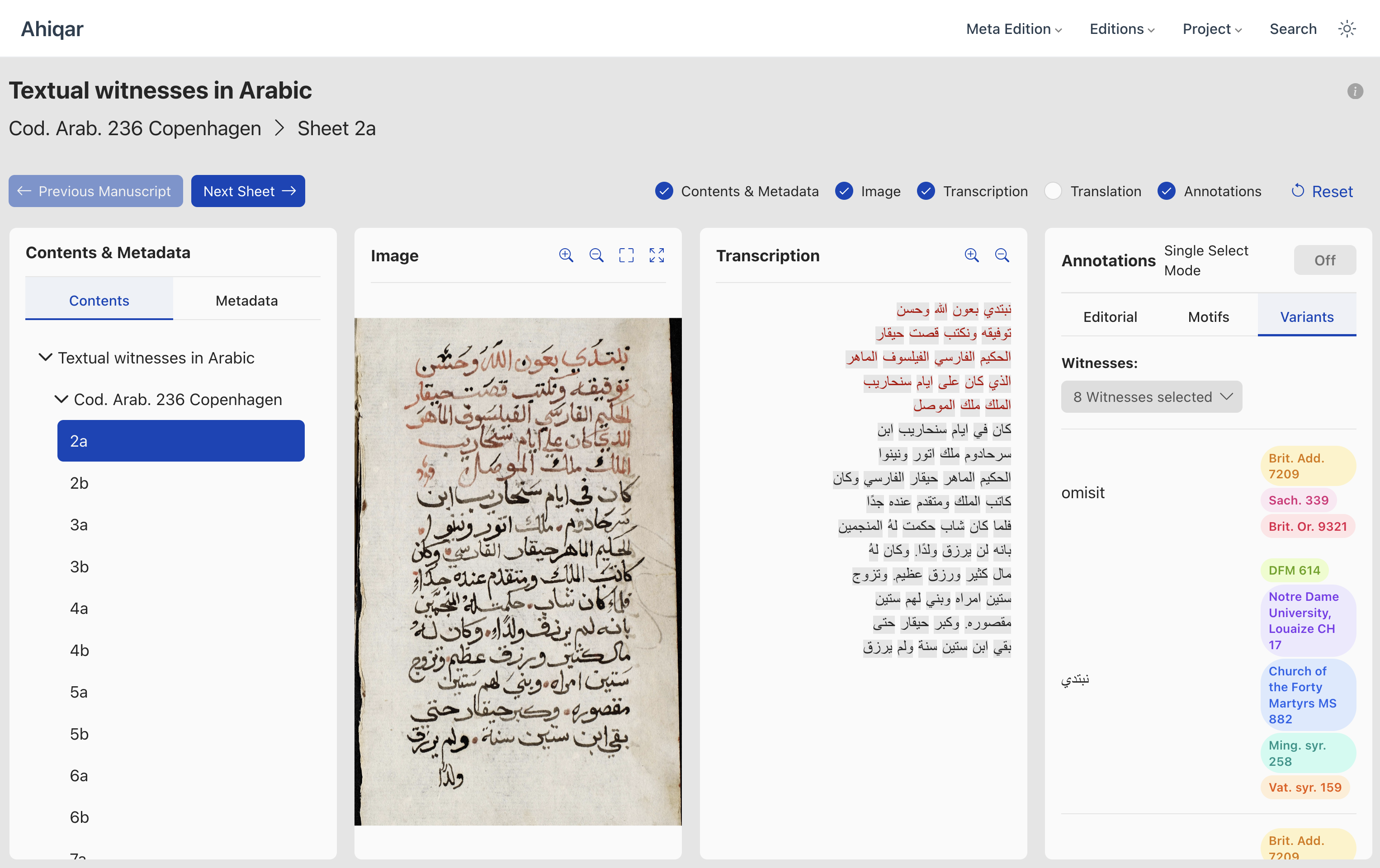
In order to improve the interoperability and scalability of different projects with the aim of providing texts, the SUB Göttingen is developing a generic API specification (TextAPI) and an associated web application for displaying different text resources and accompanying material (TIDO), following a modular approach. The interaction of both components has been established in various projects.
The TextAPI is a middleware for the provision of text data and associated metadata. It was developed on the basis of the FRBR concept and is modeled on IIIF. Metadata and references to different text representations (serializations) can be specified via predefined REST endpoints. The specification is largely agnostic to the technology used. It only prescribes the JSON-compliant output of the metadata.
In addition to the TextAPI, annotations are offered for the actual texts in accordance with a W3C specification. This means that associated job comments, register data or any other data can be referenced and delivered.
The TextAPI itself is organized modularly.
TIDO Viewer is a configurable, expandable and easy-to-integrate text viewer developed for displaying digital editions. TIDO has been optimized to display resources provided via TextAPI. TIDO provides panels to display various text representations, metadata and images of your collection, manuscript or object. The panels are customizable via the code configuration and on the user side.
- The content panel offers simple navigation via the structural elements of an object or collection.
- The text panel shows the actual text object at the lowest level (usually page level). The content can be displayed in a resource-specific style.
- In the image panel, associated image objects can be viewed with zoom and full-screen mode.
- The metadata panel shows a basic set of metadata, which can be expanded for specific resources.
- The panels are optional and can also be shown or hidden by the user. Only the text panel and the metadata panel are mandatory.
Examples can be viewed via the demo version of the viewer.
TIDO is available under GNU Affero General Public License. A demo installation and the TIDO source code are available on GitHub.
TextAPI is licensed under CC-BY-ND-4.0. Its description is provided on the TextAPI website and can be reused.
Examples for use:
Image Database GöPix
At the Georg-August-Universität Göttingen, image data is generated in the various facilities such as faculties, institutes and chairs. These may be scanned graphics, photographed experimental setups or other images. This image data can be used to document research or for teaching purposes.
In order to facilitate retrieval during research, these images are described by metadata such as title, author, source references, etc.
The SUB Göttingen offers the University's institutions the GöPix database system for recording and researching image data. The SUB Göttingen is responsible for operating the system and supporting the institutions that use it.
The GöPix system is based on the easydb software, which is widely used for similar purposes in German-speaking countries.
The constantly growing network of other institutions using this software is intended to enable joint research in the holdings of several scientific institutions.
The GöPix system currently only allows members of certain institutes to access their own data; guest access to existing data is currently not possible.
DARIAH-DE Geo-Browser
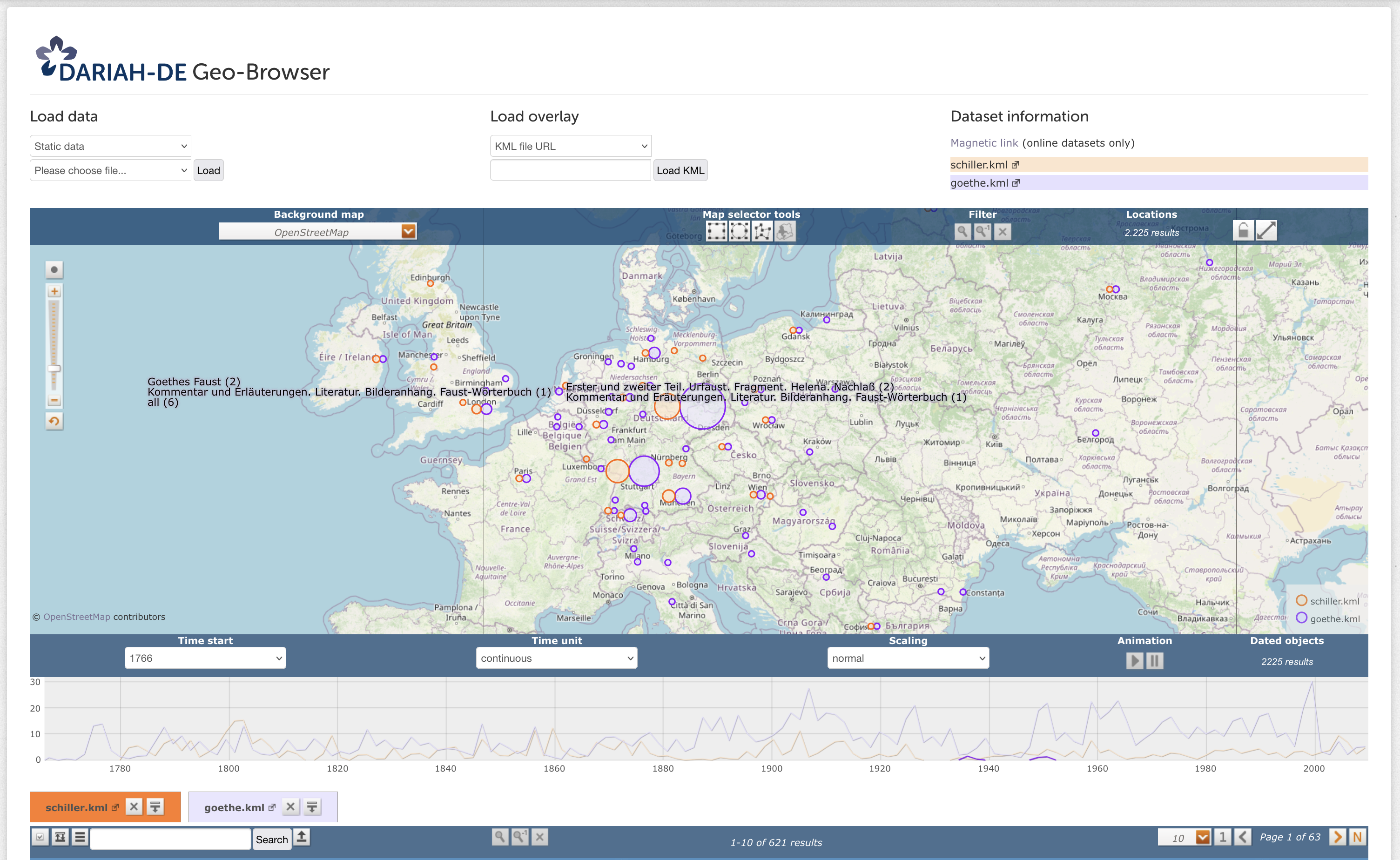
The DARIAH-DE Geo-Browser enables a comparative visualization of several queries and supports the display of data and their visualization in a correlation of geographical spatial relationships at corresponding points in time and time sequences. This allows researchers to analyze space-time relations of data and source collections and at the same time establish correlations between them. Here is an example dataset for the geo-browser, in which the publication times and locations of publications by Friedrich Schiller and Johann Wolfgang von Goethe are plotted against each other.
All functions are freely accessible without registration. The Geo-Browser is a tool for the visualization and analysis of space-time relations for humanities scholars. The browser shows a map of the world. The map can be zoomed in or out by scrolling. There is a bar on the left where you can also zoom in or out by dragging in the direction of "+" or "-".
The research questions to be answered with the geo-browser are manifold. The Geo-Browser is an interdisciplinary tool or service that can analyze space-time relations from a wide range of perspectives. For example, questions about the locations where archaeological objects were found, the birthplaces of people or socio-economic or political events. At the same time, data sets can be correlated with each other, for example to clarify the historical question of what effects famines in 18th century Europe had on political stability and whether there is a correlation with revolutions.
In addition, the geo-browser can also be used as a visualization tool, for example to display DH projects or DH degree courses and their geographical and temporal development over the last ten years.
Humanities and cultural studies researchers, journalists and the interested public alike can use this open source tool to explore complex data and thus answer both temporal and spatial questions.
DARIAH-DE Datasheet Editor
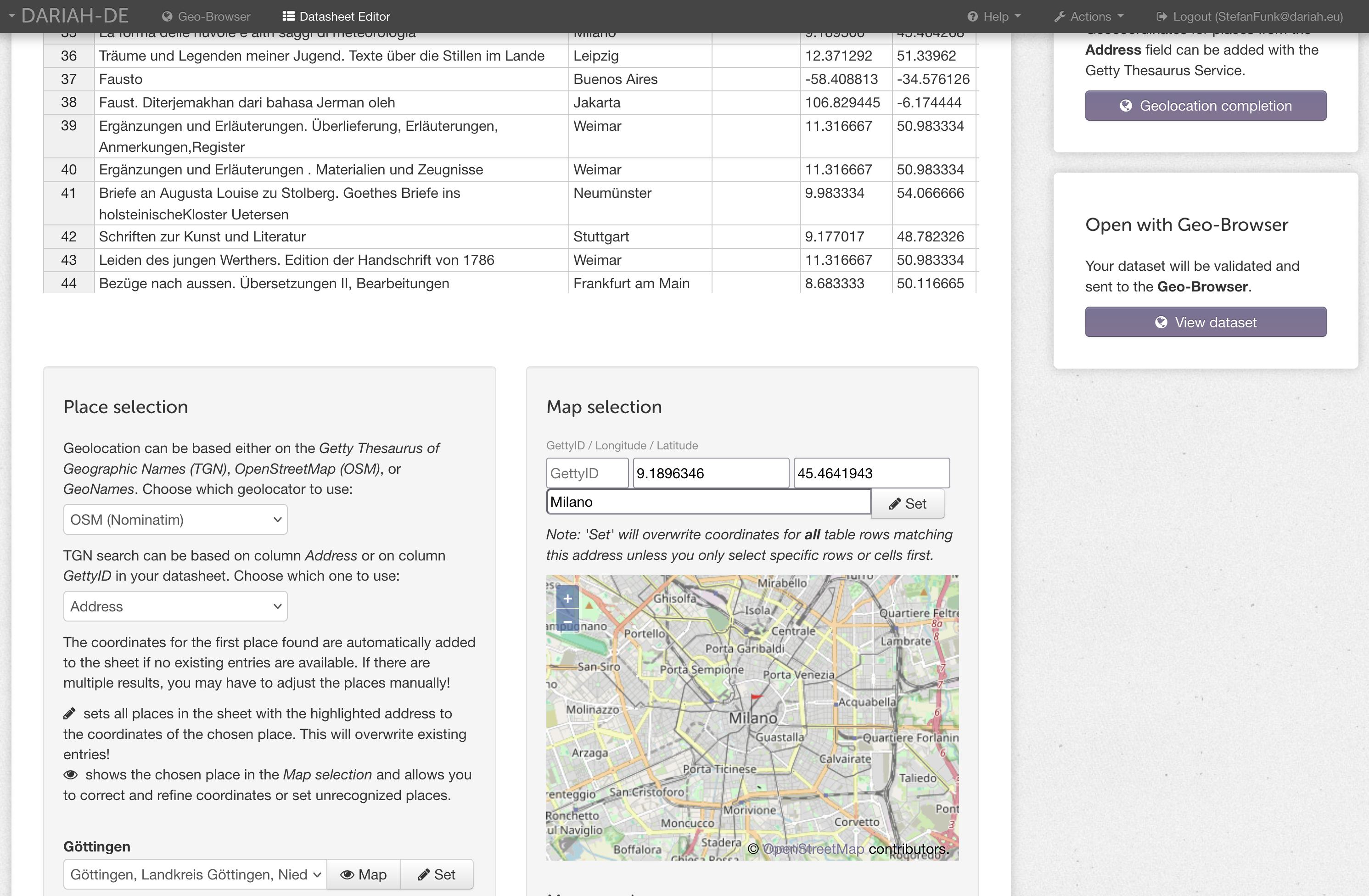
The Datasheet Editor is a user-friendly tool for preparing data for the geo-browser and organizing it in a meaningful way for visualization. Thanks to the seamless integration of various data sources (online or local) such as KML, KMZ, CSV or Excel files, time and location data can be easily imported and edited.
The Datasheet Editor is suitable for research, science and personal projects and it allows you to share your datasets with the world and provides a convenient way for data visualization and collaboration.
Datasets can be georeferenced either manually or semi-automatically by using multiple standard datasets. This data is transferred to the geo-browser and displayed on a geographical map as standard. The Getty Thesaurus of Geographic Names (TGN), OpenStreetMap (OSM) and GeoNames are available for this purpose. In addition, historical maps can also be used, on which the political, social and economic conditions of a particular era are shown.
DARIAH-DE Publisher
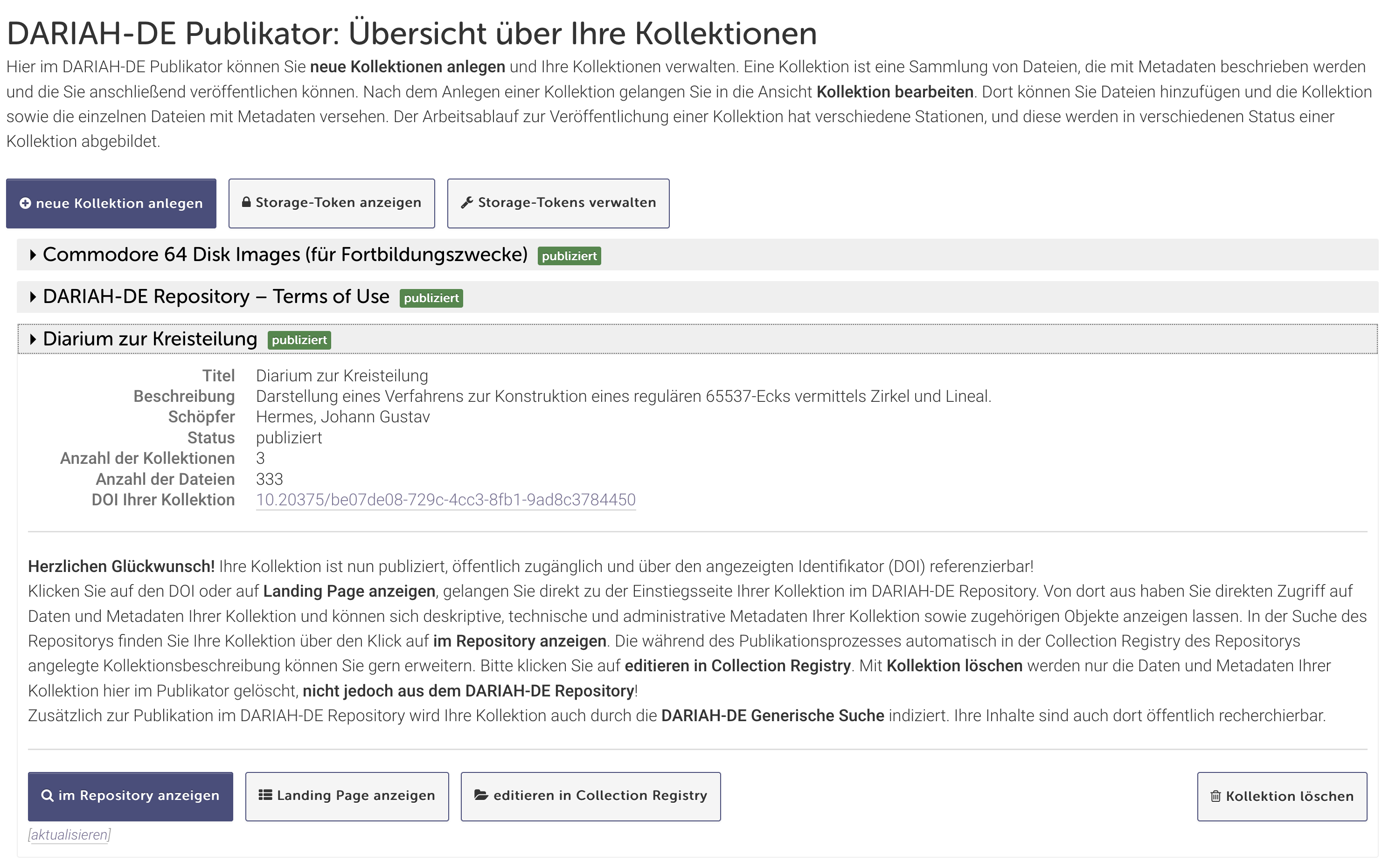
The entry point for importing collections and data into the DARIAH-DE repository is the DARIAH-DE Publisher, which allows you to prepare and manage your collections for import into the DARIAH-DE repository and finally to import them into the repository.
Detailed documentation on using the Publikator can be found in the DARIAH-DE repository documentation.
DARIAH-DE Standardization Data Services
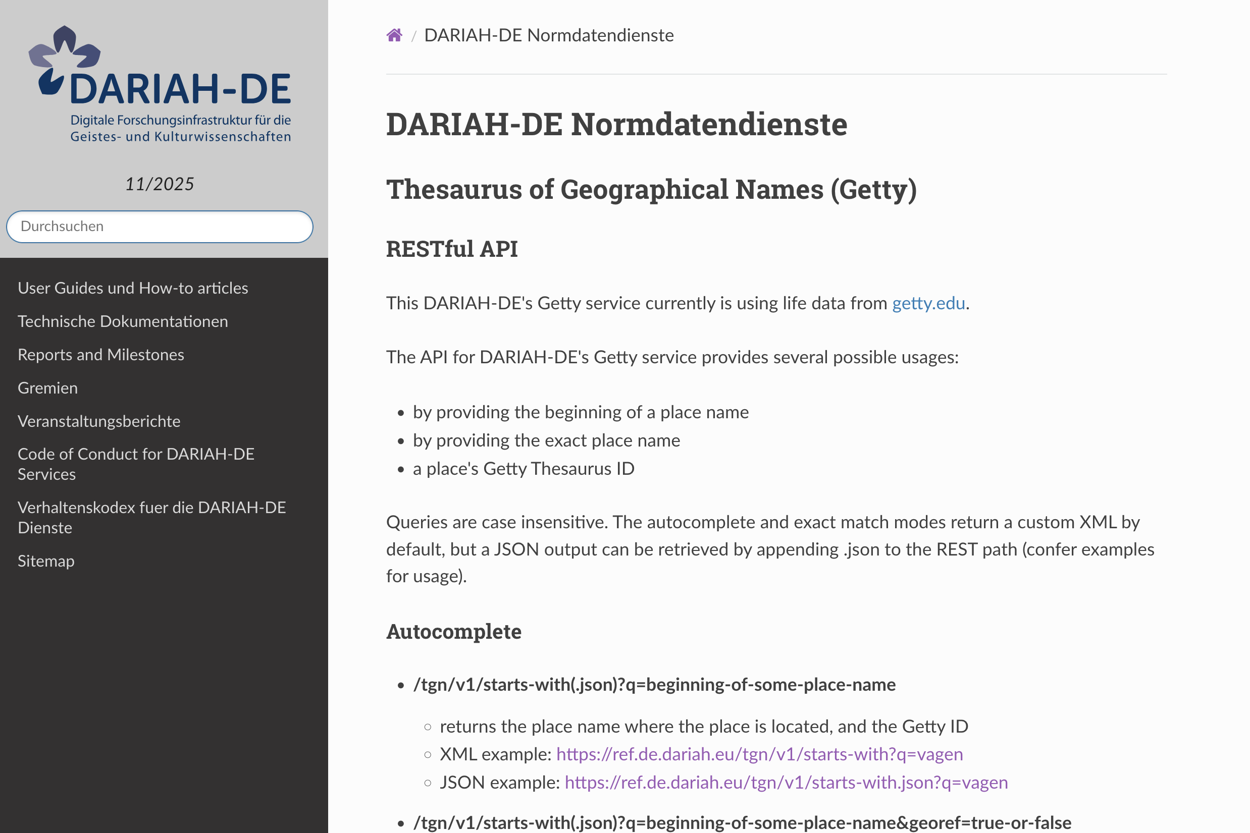
DARIAH-DE provides the Getty Thesaurus of Geographic Names (TGN) and personal data from the Gemeinsame Normdatei (GND) as a service via a REST interface. The interface to the TGN is used, for example, by the geo-browser, while the GND interface is used, among other things, to extract personal data for TextGrid metadata.
Both interfaces are available to users; the documentation of the interfaces can be found in the DARIAH-DE documentation.
DARIAH-DE Annotation Sandbox
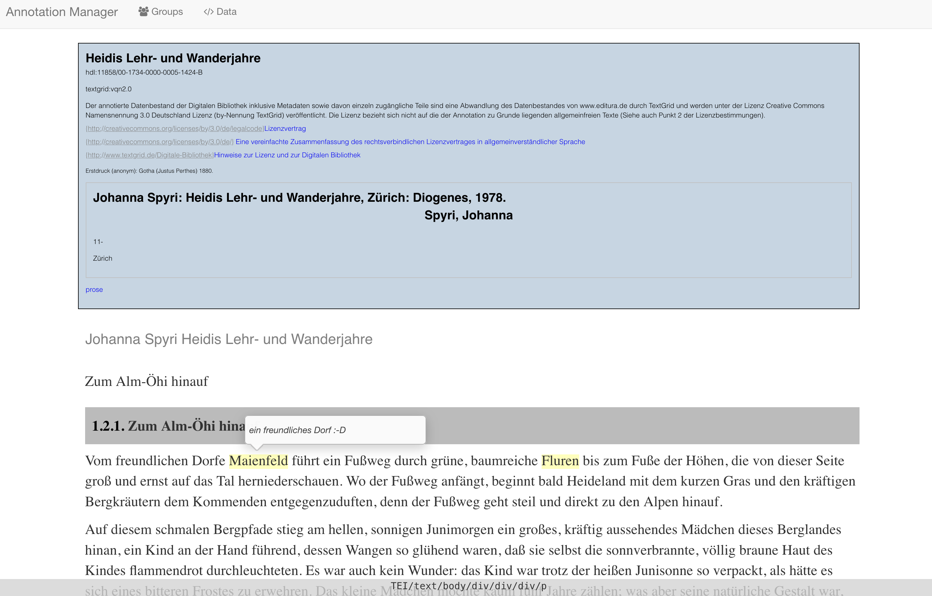
One part of the Annotation Sandbox is the Annotation Viewer. It is a web-based annotation tool that enables users to mark up texts with simple annotations.
The beta version of the annotate function in the TextGrid Repository offers the possibility to load texts from the TextGridRep into the Annotation Viewer in order to perform the annotation directly there. The Annotation Viewer is a web application; downloads and installations are therefore not necessary and users access external servers so that users do not require large computing capacities. The step of downloading texts from TextGridRep and then loading them back into the Annotation Viewer is no longer necessary.
The Annotation Viewer is documented in the TextGrid Repository and is part of the DARIAH-DE Annotation Sandbox.
GRO GeoMapper
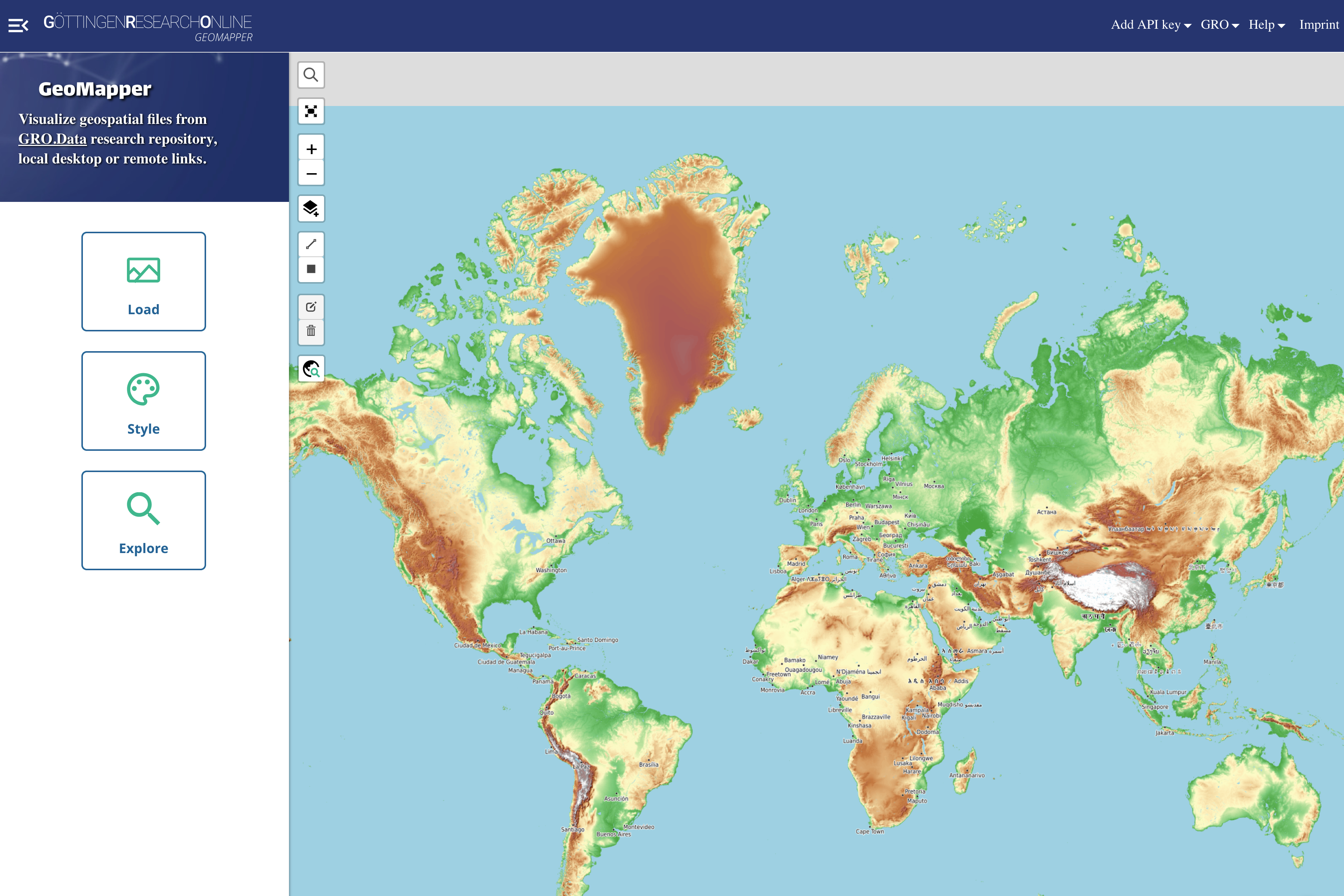
The React-based web application GeoMapper makes it possible to visualize geodata stored in GRO.data on a map. It can be integrated into GRO.data and GRO.data can also be searched from within the application via the API interface. It can also be used to visualize local files. There is no separate server-side storage of data.